Automated Mapping of Coastal Habitat Cover and Land-Use Change
On behalf of the Gordon and Betty Moore Foundation, Clark Labs has been engaged in a series of projects to map aquaculture and coastal habitats. Clark Labs uses high-resolution satellite imagery and geospatial analysis to visualize and analyze historical landscape changes for critical wetlands habitats, including mangroves and aquaculture pond cover in major shrimp exporting countries around the world. An interactive web map showing the aquaculture data is accessible on Clark Labs' website.
As one of the Remote Sensing/GIS Automation Assistant at Clark Labs, I have been involved in producing baseline maps and coding for automated mapping procedures.
Baseline Mapping of Aquaculture and Coastal Habitats
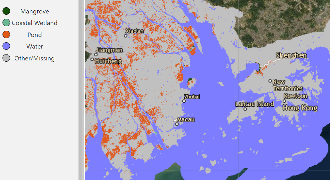
In total, 6 classes were mapped for the years 1999, 2014, and 2018: Mangrove, Wetland, Pond Aquaculture, Water, Other land cover and Missing. The landcover maps for 2014 and 2018 are based on Landsat 8 imagery and the landcover maps for 1999 data are based on Landsat 5 imagery.
For all but the pond aquaculture class a Mahalanobis classifier was used. Within each image, I delineated polygons around some examples of specific classes. The Mahalanobis classifier then computed a probability image known as a typicality that indicates for each pixel how typical it is of the class it was trained on. This would then be thresholded to yield a hardened class.
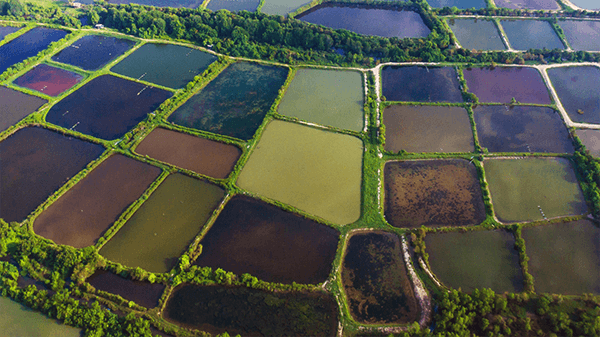
For pond aquaculture, a very different procedure was used. Inspired by the characteristics of a Convolutional Neural Network (CNN) a procedure was developed in which the Landsat TM bands are augmented by derivative indices and convolutional filters of inputs. Polygons around examples of ponds and examples of a broad class called “not pond” were delineated. Multi-Layer Perceptron (MLP) neural network was then used for the classification.
Automated Mapping Procedures
Since 2020, Clark Labs has developed automated spatial and temporal maps of coastal habitat cover and land-use change by which to evaluate the impacts of shrimp farming on mangrove forests. Procedures in Baseline Mapping have been programmed to be automated, which saved a lot of manpower and increased productivity.
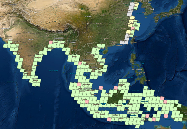
(Each grid is a landsat 8 scene. grey = ready to process, yellow = in progress, red = check needed, green = done)
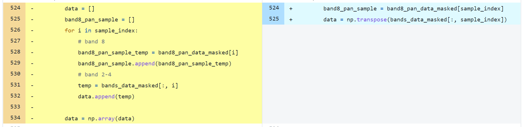
I have been involved in developing automated procedures using Python. My main task is to revisit all codes and rewrite the codes to improve the runtime of the mapping processes. As of October 2021, I successfully reduced the processing time by 60%.
Citation
- Eastman, J.R., Crema, S.C., Sangermano, F., Cunningham, S., Xiao, X., Zhou, Z., Hu, P., Johnson, C., Arakwiye, B., and Crone, N., (2015) “A Baseline Mapping of Aquaculture and Coastal Habitats in Thailand, Cambodia and Vietnam”, Aquaculture and Coastal Habitats Report No. 1
- Eastman, J.R., Toledano, J., and Crema, S., (2018) “A Baseline Mapping of Aquaculture and Coastal Habitats in Myanmar”, Aquaculture and Coastal Habitats Report No. 3