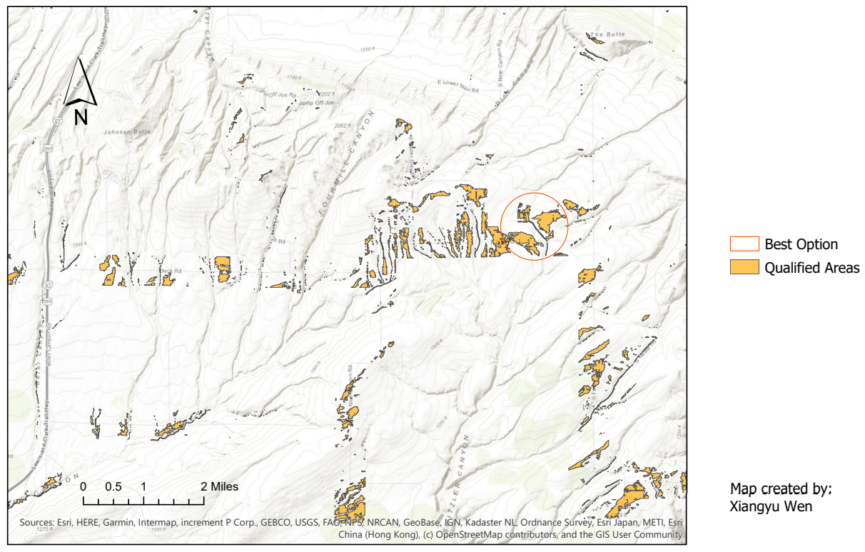
Site Investigation for Commercial Solar Installation Using ArcGIS
This project utilizes spatial techniques within ArcGIS Pro to narrow down optimal choices of potential areas south of Kennewick, WA, for commercial solar panel installation. The analysis process takes into account maximizing solar irradiation, easy maintenance, and minimizing visual pollution.
The Process
A DEM showing an area south of Kennewick, WA, was used as the data for analysis. The data was processed and analyzed to create a raster layer of the area that meets all of the following criteria:
- Under 5 percent slope
- On south-facing terrain (specifically, aspect is SW, S, or SE)
- Within 0.25 miles of an existing road
- Not visible from Interstate 82
I used Raster Calculator to convert the DEM data's unit to feet to prepare for analysis. Then, I started by creating a buffer of 0.25 miles from the road layer. After that, I used this layer to clip the polygon layer I made from the slope layer containing the areas with a slope under 5 percent. Next, I used the layer containing the areas visible from I82 and the layer containing the areas that are not facing south to erase the layer I made from the previous step. Finally, I used Calculate Geometry to calculate the total areas of all the qualified lands.
The Result
2.04 square miles of land were determined to be suitable to meet all the four criteria above.